3D annotation services turn raw LiDAR and point cloud data into the labeled geometry that robots and autonomous systems train on, and this guide ranks the top outsourcing companies for 2026 while making the case for why captured metric depth beats annotated 3D geometry for physical AI and robotics. The fastest way to judge a vendor is whether the depth in your training data is measured at capture or estimated after the fact.
Robotics teams and physical AI groups now buy 3D annotation at a scale they never did for flat images. Autonomous vehicles, warehouse robots, humanoids, and drones all need to know where things sit in metric space, not just what a pixel looks like. That demand has produced a crowded market of 3D, LiDAR, and point cloud annotation and outsourcing companies, each with a different mix of tooling, managed workforce, and sensor coverage. Full disclosure: NeuralChain AI is one of the companies profiled below, and we come at the problem from the capture side rather than the labeling side.
What 3D annotation actually covers
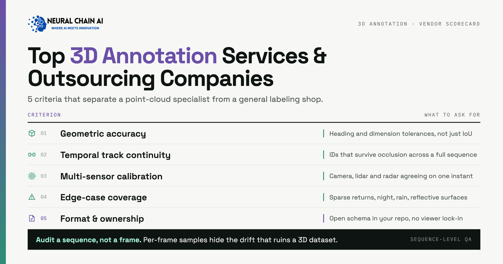
3D annotation is a broad label. In practice it spans a few distinct jobs: drawing 3D cuboids around objects inside a LiDAR point cloud, segmenting every point by semantic class, tracking objects across frames with stable identifiers, and fusing camera, LiDAR, and radar so a single label carries across sensors. Some vendors sell the software platform, some sell a managed labeling workforce, and some sell both. The right pick depends on whether you already hold raw sensor data and need it labeled, or whether you still need that data captured in the first place. It also depends on how the depth in your dataset was produced, because that decision shapes everything a model can learn about geometry.
Top 3D annotation services and outsourcing companies in 2026
The outsourcing companies below lead the 3D, LiDAR, and point cloud annotation segment. We grouped them by what they primarily deliver: an annotation platform, a managed service, or, in NeuralChain’s case, born-3D data capture.
Encord
Encord runs a unified multimodal platform that handles images, video, audio, documents, text, 3D point cloud, LiDAR, and DICOM in one place. For 3D work it supports cuboids, segmentation, keyframes, temporal labeling, and object tracking across LiDAR sequences, with full multi-sensor fusion so LiDAR and camera data annotate in sync alongside radar and thermal inputs. It streams raw sensor data in MCAP, ROS bag, PCD, PLY, nuScenes, and KITTI formats, and can render point clouds up to 20 million points per scene. In 2026 Encord expanded its LiDAR and point cloud support with a physical-AI focus, which puts it among the most complete platforms for teams that want one system across many modalities.
Kognic
Kognic is a LiDAR and sensor-fusion annotation platform purpose-built for autonomous driving, ADAS, and robotics. It offers native 3D point cloud editing, calibrated camera, LiDAR, and radar fusion, multi-LiDAR support, temporal sequence handling with ego-motion compensation, and more than 90 automated quality checkers tuned for autonomous-vehicle data. The company reports over 100 million annotations delivered across more than 120 programs, with customers that include Zenseact, Continental, Bosch, ZF, Qualcomm, Kodiak, Einride, and Gatik. If your program lives in the AV and ADAS world, Kognic is a natural shortlist entry.
Deepen AI
Deepen AI focuses on multi-sensor LiDAR annotation paired with sensor calibration. Its fusion tooling lists 3D bounding boxes, semantic segmentation, polylines, and instance segmentation, with an emphasis on handling very large point clouds. Deepen is best known for its calibration tools, which matter because sloppy calibration quietly corrupts every downstream label, and for its involvement in the Safety Pool initiative run in partnership with the University of Warwick. Teams that treat calibration as a first-class problem tend to shortlist Deepen.
Sama
Sama is a managed annotation provider that offers 3D point cloud annotation for LiDAR and radar. Its platform uses a fused sensor architecture that syncs assets for annotation, world-coordinate conversion that uses the sensor pose to move point clouds from local to world coordinates, and automatic ground detection driven by semi-supervised learning. Sama pairs that tooling with a managed workforce and quality process, which suits buyers who want deliverables rather than a tool to staff themselves.
iMerit
iMerit combines a managed workforce with a multi-sensor labeling tool for camera, LiDAR, radar, and audio data. Its annotation types include 2D-to-3D linking, 2D and 3D bounding boxes, and 3D point cloud segmentation, with AI-driven pre-labeling to reduce manual effort and automated quality rules that catch missing or misaligned objects. iMerit is a strong fit for autonomous-vehicle and geospatial programs that need scale plus review discipline.
SuperAnnotate
SuperAnnotate is a broad multimodal annotation platform spanning text, audio, images, video, and point cloud data. Its 3D and point cloud tooling is lighter than the AV-specialist platforms, but it is a capable choice for teams that want one workspace across many data types, including the language and generative workflows that increasingly sit next to perception data. Buyers who value multimodal breadth over deep LiDAR specialization often land here.
BasicAI and Mindkosh
BasicAI runs a self-developed 3D LiDAR point cloud platform with AI-assisted labeling, fusion auto-annotation, and object tracking, serving autonomous driving, manufacturing, agriculture, and robotics. Mindkosh offers LiDAR and point cloud annotation with aerial point cloud segmentation, sensor fusion that attaches multiple camera images to each point cloud frame and auto-projects annotations onto them, and object tracking with consistent identifiers across sensors and time. Both are worth a look when you want capable 3D tooling with services attached at a mid-market footprint.
NeuralChain AI
NeuralChain AI sits in a different part of the stack. We are a physical-AI and robotics data company, and rather than annotate 3D structure onto existing footage, we capture it. Every episode records calibrated metric stereo depth per frame together with tactile force arrays, a 200Hz IMU, dual wrist cameras, and 21-point hand pose, all synchronized on one clock. Each episode ships consented, with a SHA256 per-episode chain of custody, and arrives LeRobot-ready for imitation and reinforcement learning. In other words, the geometry in a NeuralChain dataset is measured at capture time, not estimated afterward. You can read more about how we structure this in our physical AI training data collection and tactile manipulation data programs.
| Company | 3D data types | Approach | Where it stands |
|---|---|---|---|
| Encord | LiDAR, point cloud, multi-sensor fusion, DICOM | Unified annotation platform | Broad multimodal reach, streams up to 20M points per scene |
| Kognic | LiDAR, camera, radar fusion | AV and ADAS annotation platform | 100M+ annotations, deep autonomous-vehicle focus |
| Deepen AI | LiDAR, sensor fusion, calibration | Platform plus calibration tools | Strong calibration, Safety Pool participant |
| Sama | LiDAR and radar point cloud | Managed annotation service | Fused sensor architecture with managed QA |
| iMerit | LiDAR, camera, radar, audio | Managed workforce plus tooling | Multi-sensor fusion with AI pre-labeling |
| SuperAnnotate | Point cloud, multimodal | Multimodal annotation platform | Broad modalities, lighter 3D specialization |
| BasicAI / Mindkosh | LiDAR point cloud, sensor fusion | Platform plus services | AI-assisted labeling and object tracking |
| NeuralChain AI | Captured metric stereo depth, tactile, IMU, hand pose | Born-3D data capture | Measures depth at capture, LeRobot-ready |
Born 3D vs retrofit 3D: why captured depth wins
Most of the market retrofits 3D structure onto data that did not start with reliable metric depth. That happens two common ways. In the first, a labeling team draws 3D cuboids while looking at 2D camera frames, then projects those boxes into space. In the second, geometry is estimated from monocular video by a depth network that guesses how far away each pixel is. In both cases the depth is inferred, and a labeler’s or a model’s estimate of distance becomes the ground truth your policy trains on.
LiDAR annotation is a real step up here, because a LiDAR point cloud is measured depth, not a guess. That is exactly why the AV specialists above are strong. The remaining gap is that the labels layered on top, the class, the track identifier, the exact box extent, are still human estimates, and the moment a program leaves the LiDAR-equipped vehicle world for manipulation, tabletop robotics, and dexterous hands, most 3D datasets fall back to retrofitting boxes onto flat images.
For physical AI this matters because a robot policy learns spatial relationships from whatever depth it is given. If that depth was estimated, the policy inherits the estimate, including its blind spots at edges, reflective surfaces, and thin structures. Captured metric depth removes that layer of translation. NeuralChain captures calibrated metric stereo depth per frame at collection time, then synchronizes it with tactile force, proprioception, and hand pose on a single clock. The result is a dataset where geometry is measured rather than annotated. If you are weighing a build for embodied systems, our physical AI and robotics consulting and development team can help you decide where captured depth and annotated 3D each fit.
Deciding between labeling existing sensor data and capturing born-3D data for your robots? Talk to the NeuralChain team through our physical AI and robotics consulting and development practice, and we will map the right mix of captured metric depth and 3D annotation for your program.